
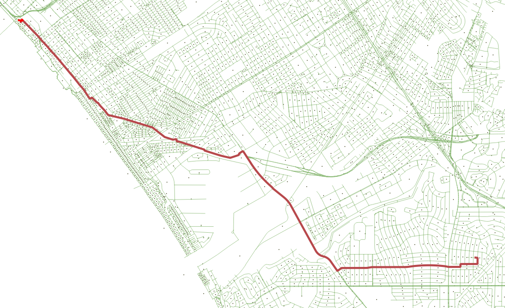
I am trying to use the graph-tool to perform a huge automated series of path analyses as part of a commute-justice project I am working on. I am very new to graph-tool and somewhat new to Python. I have converted an ESRI shapefile of street centerlines in Los Angeles County into a GT file using this short script: https://github.com/CordThomas/shp2gt - i think it creates a valid graph-tool network. Prior to that conversion I made sure the OpenStreetMap centerlines were split at all intersections. Running the code below gives me INF as the output to the dist_map returned from the shortest_path request. What diagnostics might i try to check the traversal of my network? Running this on the Shapefile used to create the GT, I am able to use QGIS to produce the shortest_path - see screenshot attached. [image: Screen Shot 2018-11-29 at 1.54.38 PM (2).png] I'd be glad to post my GT file somewhere if others wanted to poke at this Thank you in advance, Cord Thomas Code: from graph_tool import util as gutil from graph_tool import topology as gtopo from graph_tool.all import * g = Graph(directed=False) g.load('/ds/data/spatial/Network/streets/ tl_2016_06000_roads_la_clipped_extended_split.gt') vertex_geoid = g.vertex_properties["geoid"] vertices = gutil.find_vertex(g, vertex_geoid, '060372760005003') start_vertex = vertices[0] vertices = gutil.find_vertex(g, vertex_geoid, '060377019023041') end_vertex = vertices[0] dist_map = gtopo.shortest_distance(g, source=start_vertex, target=end_vertex, weights=g.edge_properties['weight_dist']) dist_map returns inf output of some data for verification:
start_vertex
<Vertex object with index '7783' at 0x7f91c35693f0>
end_vertex
<Vertex object with index '11265' at 0x7f91c35696f0>
g.num_edges()
560517
g.num_vertices()
549021
participants (1)
-
 Cord Thomas